Kaimai Road Closures Today: SH29 Live Status & Alerts
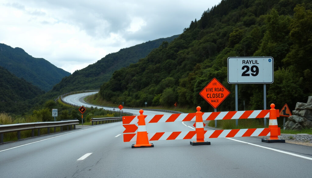
If you drive the Kaimai Range regularly, you’ve probably learned to check before you go. SH29 links the Waikato and Bay of Plenty through mountainous terrain that demands frequent maintenance—and that means closures. The most recent overnight closure wrapped up in February 2026, with rock scalers working at Ruahihi Bluffs for five nights straight. Here’s what you need to know about the road’s current status, how to stay informed, and what to expect as summer strengthening work continues through 2026.
Primary Road: SH29 Kaimai Ranges · Recent Closure: February 2026 rock scaling · Official Checker: journeys.nzta.govt.nz · Affected Regions: Waikato and Bay of Plenty · Traffic Management: Temporary stop/go sites
Quick snapshot
- February 2026 rock scaling at Ruahihi Bluffs closed SH29 for five nights (Sun Live news)
- Closure windows from 8pm to 3:30am, with hourly resident access (NZTA Journey Planner)
- Summer strengthening on Bay of Plenty side through May 2026 (National Road Carriers Bay of Plenty report)
- Whether SH29 has additional unplanned closures beyond the scheduled programme
- Live status right now requires a direct check at journeys.nzta.govt.nz
- Five-night overnight closures: December 2025 and February 2026
- Summer strengthening runs through May 2026
- Waikato-side widening near Taotaoroa and Totman roads to finish April 2026
- Check journeys.nzta.govt.nz for any upcoming announced closures
- Expect periodic lane shifts on Bay of Plenty side through May 2026
- Right-turn bay at Taotaoroa and Totman roads scheduled for October 2026–March 2027
This detailed table records the key verified facts about SH29 closures, maintenance windows, and project milestones sourced from official traffic bulletins and road carrier reports.
| Detail | Verified value | Source |
|---|---|---|
| Most recent rock scaling closure | Sunday 22 February 2026, five nights | Sun Live news |
| Rock scaling closure time window | 8:00 PM to 3:30 AM each night | NZTA Journey Planner |
| December 2025 rock scaling closure | Sunday 7 December 2025 to Friday 12 December 2025 | NZTA Journey Planner |
| Residency access during closures | Highway opens on the hour every hour for residents | NZTA Journey Planner |
| Closure points (Waikato side) | SH29/24 and SH29/28 intersections | NZTA Journey Planner |
| Closure points (Bay of Plenty side) | SH29/Cambridge Road intersection | NZTA Journey Planner |
| Valley View Road rebuild length | Approximately 1.5 kilometres | National Road Carriers Bay of Plenty report |
| Summer strengthening programme end | May 2026 | National Road Carriers Bay of Plenty report |
| Taotaoroa and Totman roads widening completion | Towards end of April 2026 | National Road Carriers Waikato report |
| Right-turn bay implementation | October 2026–March 2027 sealing season | National Road Carriers Waikato report |
| SH34/SH30 resurfacing sites | 8 sites | National Road Carriers Bay of Plenty report |
| SH34/SH30 resurfacing scheduled date | Wednesday 29 October | National Road Carriers Bay of Plenty report |
Is the Kaimai road open today?
The short answer depends on when you’re reading this. SH29 through the Kaimai Ranges has seen multiple overnight closures over the past year, most recently in February 2026 when rock scalers worked at Ruahihi Bluffs for five consecutive nights. To get the current live status, check the official NZTA Journey Planner traffic and travel list view or follow NZTA Waka Kotahi on Facebook for alerts.
Rock scaling at Ruahihi Bluffs required abseilers working above SH29 during the overnight closures between 8pm and 3:30am. The highway was fully closed at Ruahihi and other sites but opened on the hour every hour each night to allow residents through, and emergency services had access at all times.
The implication: without checking the official Journey Planner, you cannot confirm current SH29 status—the road has closed multiple times for maintenance and any future weather disruption could trigger additional unplanned closures.
The February 2026 closure followed a similar pattern to December 2025 when five nights of rock scaling work was initially scheduled but then rescheduled due to predicted poor weather. Weather remains a factor that can shift future closure plans—always verify before you travel.
How can I check for NZ road closures?
New Zealand’s official road status hub is the NZTA Journey Planner traffic and travel list view. This page aggregates closures, restrictions, and incidents across all state highways in one searchable list. You can filter by region, check estimated clearance times, and view detour options where available.
The same platform provides access to traffic cameras across the state highway network. The cameras covering SH29 give you a real-time visual check on conditions—not just whether the road is open, but how traffic is flowing if it is.
The pattern: NZTA updates the Journey Planner as conditions change, and social posts on the NZTA Waka Kotahi Facebook page often surface updates faster than official bulletins. For planned closures, bulletins typically publish days in advance with full timing, closure points, and detour routes.
Bookmark the traffic and travel list view before you leave. It takes seconds to check and can save you a significant detour if there’s an active closure on SH29.
How do I find out road closures in my area?
Beyond the national Journey Planner, regional pages give you localised updates. The NZTA Waikato traffic updates page covers SH29 in the Waikato region, while the Bay of Plenty equivalent serves drivers on the eastern side of the range.
For the fastest push alerts, follow NZTA Waka Kotahi on Facebook and the NZTA Waikato and Bay of Plenty Facebook page. Social posts often surface before official bulletins are updated, and they include context that the raw list view sometimes lacks.
What this means: regional Facebook pages deliver localised alerts that often beat official bulletins, making them essential for drivers who need the most current information on closures affecting their specific route.
Road closures today near Tauranga?
Drivers heading toward or through the Bay of Plenty should check the National Road Carriers Bay of Plenty road report for ongoing work in the area. Beyond SH29, nearby state highways including SH2 see their own maintenance and restriction programmes.
SH29 and SH2 traffic have been diverted onto temporary lanes northbound to Mount Maunganui and Tauranga CBD at Takitimu Drive during peak works. Shoulder closures with 30km/h speed limits are common along the corridor during active projects. The Bay of Plenty road report provides a weekly snapshot of what road users can expect across multiple highways in the region.
The catch: shoulder closures with 30km/h limits persist throughout active Bay of Plenty projects, so drivers should budget extra travel time even when main lanes appear open.
What causes the most road closures in NZ?
In New Zealand, state highway closures fall into a few predictable categories. Rock scaling and slope stabilisation work— مثل those at Ruahihi Bluffs—requires closing the road because crews are working at height above live traffic lanes. This is the type of work that produced the recent five-night closures on SH29.
Road reconstruction projects like the 1.5-kilometre rebuild near Valley View Road bring lane shifts and periodic closures as crews work through different stages. Resurfacing work, such as the SH34/SH30 project involving 8 sites between late October dates, involves hard closures with defined detour routes.
SH29 near Taotaoroa and Totman roads intersection is currently under traffic management including day and night stop/go controls, contraflow arrangements, and a 30km/h speed limit for the road widening work. The project accommodates a new right-turn bay, with the widening portion expected to finish towards the end of April 2026.
The pattern: rock scaling produces the longest closures because crews working above the road cannot share space with traffic, while reconstruction and resurfacing work allows for staged lane shifts that keep at least one direction moving.
How to check the current SH29 Kaimai status
Whether you’re planning a trip or already on the road, here’s a practical workflow for checking SH29 status:
- Start with the official list view. Visit NZTA Journey Planner traffic and travel list view and filter for SH29 or the Waikato and Bay of Plenty regions. The page shows active incidents, upcoming planned works, and estimated clearance times.
- Check the cameras. Click through to the traffic cameras page and select the SH29 cameras. You get a real-time visual—confirming whether the road is clear and seeing how traffic is flowing.
- Follow NZTA on social media. The NZTA Waka Kotahi Facebook page posts updates on closures and incidents, often ahead of official bulletins. The regional Waikato and Bay of Plenty page gives localised alerts.
- Review the Bay of Plenty road report. The National Road Carriers Bay of Plenty road report provides a weekly summary of works across multiple highways, including any shoulder closures, stop/go sites, or speed restrictions active on SH29.
- Know your detour options. If SH29 is closed, the standard northbound detour is SH2 via Karangahake Gorge, SH24, SH27, and SH26. Southbound alternatives for all vehicles are SH5, SH30, SH33, and SH2 via Rotorua. Light vehicles can use SH5 and SH36 via Rotorua. During the December 2025 closures, SH28 was also closed at the Harwood Road/SH5 intersection, so check current detour conditions rather than relying on a single route.
What this means: the most reliable status check combines Journey Planner data, camera visuals, and social media alerts—but knowing your detour routes before you leave is what actually saves you when an unexpected closure appears.
The February 2026 rock scaling at Ruahihi Bluffs required five nights of overnight closures precisely because abseilers were working above the road. It’s not feasible to keep a lane open when crews are removing loose rock from bluffs above moving traffic. The closures are disruptive, but they exist because the alternative—leaving unstable material above the road—is worse.
SH29 Kaimai Range closure timeline
Recent rock scaling closures on SH29 followed a consistent pattern: five consecutive nights of overnight work, with the highway closed between 8pm and 3:30am. The December 2025 programme at Ruahihi Bluffs was initially scheduled for an earlier date but rescheduled due to predicted poor weather. The February 2026 closure ran from Sunday 22 February for five nights.
This timeline table shows the key closure events and maintenance milestones sourced from official NZTA bulletins and road carrier reports.
| Period | Event | Source |
|---|---|---|
| December 2025 | Five-night rock scaling at Ruahihi Bluffs, initially rescheduled due to poor weather | NZTA Journey Planner |
| September 2025–May 2026 | Temporary traffic management on SH29 near Valley View Road for summer strengthening works | National Road Carriers Bay of Plenty report |
| February 2026 | Five-night rock scaling overnight work at Ruahihi Bluffs | Sun Live news |
| May 2026 | Road widening at Taotaoroa and Totman roads intersection expected to finish | National Road Carriers Waikato report |
| May 2026 | SH29 summer strengthening works on Bay of Plenty side scheduled to complete | National Road Carriers Bay of Plenty report |
| May 2026–May 2026 | Right-turn bay at Taotaoroa and Totman roads intersection scheduled for implementation | National Road Carriers Waikato report |
The implication: rock scaling and road strengthening work will continue to produce periodic overnight closures through at least May 2026. The Waikato-side widening at Taotaoroa and Totman roads finishes before the Bay of Plenty strengthening programme wraps up, but the right-turn bay implementation is already on the horizon for late 2026 into 2027.
Confirmed facts and open questions
Confirmed
- Five-night overnight rock scaling closures occurred in December 2025 and February 2026
- Closure windows ran from 8pm to 3:30am with hourly resident access
- Emergency services retained access throughout closure periods
- Summer strengthening works on SH29 Bay of Plenty side ongoing through May 2026
- Valley View Road rebuild involves approximately 1.5 kilometres of road
- Passing lane near Valley View Road closed for duration of strengthening works
- Temporary traffic management active on SH29 near Taotaoroa and Totman roads with stop/go controls and 30km/h limits
- Road widening at Taotaoroa and Totman roads expected to finish towards end of April 2026
- SH34/SH30 resurfacing involves 8 sites, scheduled for late October with hard closures and detours
Unclear
- Whether any unplanned closures have occurred beyond the scheduled programme
- Current live status of SH29 without checking journeys.nzta.govt.nz directly
- Whether additional weather-related schedule changes will affect upcoming works
- Exact timing of any future announced overnight closure programmes
Due to an oil spill and truck breakdown, SH29 on the Kaimai Ranges is closed in both directions.
— NZTA Waka Kotahi, Facebook update
State Highway 2 through Waioweka Gorge will close from 6pm Saturday until 10am Monday.
— NZTA Waikato and Bay of Plenty, Facebook update
For drivers who rely on SH29, the picture is clear: the road is actively maintained, which means periodic overnight closures are part of the reality. The most recent rock scaling programme ran five nights in February 2026, and the summer strengthening works on the Bay of Plenty side continue through May 2026. The Waikato-side widening at Taotaoroa and Totman roads should finish by late April 2026.
The trade-off is straightforward: closures in the short term prevent bigger problems down the road. Loose rock above a live traffic lane isn’t a situation anyone wants to contemplate. For Waikato and Bay of Plenty drivers, the best move is to check the NZTA Journey Planner before you leave, follow the regional Facebook pages for the fastest alerts, and know your detour routes before you need them.
Related reading: real estate agents Hamilton · motorhome rental New Zealand
nzherald.co.nz, natroad.co.nz, journeys.nzta.govt.nz, opendata-nzta.opendata.arcgis.com, journeys.nzta.govt.nz, journeys.nzta.govt.nz
Frequently asked questions
What is the best app to check road conditions in New Zealand?
The NZTA Journey Planner is the official hub for state highway status across New Zealand. It aggregates closures, incidents, and restrictions in one searchable list. The Journey Planner website works well on mobile browsers if you prefer not to install additional apps.
How to view traffic cameras in New Zealand?
Visit the NZTA traffic cameras page and select your region or specific highway. Cameras covering SH29 give a real-time visual check on conditions. The camera feeds update regularly and require no login to access.
What are the detour routes when SH29 Kaimai is closed?
When SH29 is closed, northbound traffic typically diverts via SH2 through Karangahake Gorge, then SH24, SH27, and SH26. Southbound, all vehicles can use SH5, SH30, SH33, and SH2 via Rotorua. Light vehicles have the additional option of SH5 and SH36 via Rotorua.
How often does NZTA update road closure information?
NZTA updates the Journey Planner as conditions change, and social media posts on the NZTA Waka Kotahi Facebook page often surface updates quickly. For planned closures, bulletins are typically published days in advance with full details on timing, closure points, and detour routes.
Are there SH2 closures today?
Check the NZTA Journey Planner traffic and travel list view for the most current SH2 status. SH2 through Waioweka Gorge has had scheduled closures—for example, a closure from 6pm Saturday until 10am Monday—and any active closures will appear on the official list.
What roadworks are happening in Bay of Plenty?
The National Road Carriers Bay of Plenty road report provides a weekly overview of works across the region, including SH29 strengthening works near Valley View Road, SH34/SH30 resurfacing at 8 sites, and shoulder closures with speed restrictions along various state highways.
Is there a Kaimai road closures map available?
The NZTA Journey Planner traffic cameras provide visual confirmation of conditions at specific points along SH29. For a broader map view, the Journey Planner’s interactive elements show camera locations and incident markers across the state highway network.
What is the 4-second rule for driving in New Zealand?
The 4-second rule is a standard following distance guideline in New Zealand. Under good conditions, drivers should maintain at least a 4-second gap between their vehicle and the one ahead. During wet or slippery conditions, increase to a 6-second gap. This gives adequate stopping distance at speed, particularly important on winding roads like SH29 through the Kaimai Range.
More related posts
 Otago Southland Heavy Snow: Warnings Forecasts Roads
 Eru Kapa-Kingi – 28-Year-Old Māori Activist and Law Lecturer
 Car for Sale Auckland: Used & New Under $10k Deals
 Fantastic Mr Fox Book: Summary, Age Rating & Review
 Synopsis of Heart Bones: Plot, Review & Age Rating
 Miss Dior Blooming Bouquet: Scent, Longevity & Reviews
 INZ Accredited Employer List: Check & Find Visa Jobs
 How to Delete Instagram Accounts Permanently: Full Guide