Otago Southland Heavy Snow: Warnings Forecasts Roads
If you’re driving anywhere near the southern Alps or Fiordland this week, you’ll want to check the forecast twice. A cold blast rolling up from the Tasman Sea has already dropped snow on two of the region’s key alpine roads, and MetService has road snowfall warnings in effect for Milford Road and Crown Range Road.
Snow Depth: Up to 6cm above Homer Tunnel ·
Affected Roads: Milford Road (SH94) and Crown Range Road ·
Warning Areas: Lower South Island ·
Issuer: MetService ·
Start Time: Wednesday evening
Quick snapshot
- Road snowfall warnings issued for Milford Road and Crown Range Road (Otago Daily Times)
- Up to 6cm snow possible about Homer Tunnel on Milford Road (MetService official forecast)
- Strong Wind Watch active for coastal Otago, Southland, and Stewart Island until 3pm (Otago Daily Times)
- Exact snow totals beyond the 6cm forecast for Homer Tunnel
- Whether an orange wind warning will actually be upgraded from current watch status
- Duration of road snowfall warnings if conditions persist
- Sunday 19 Apr morning: Snow falls on Crown Range and Milford Roads (Otago Daily Times)
- Sunday 19 Apr: Strong Wind Watch active until 3pm for coastal regions (Otago Daily Times)
- Monday 20 Apr: Heavy Rain Watch for Otago headwaters from 10am to 9pm (11 hours) (Otago Daily Times)
- More heavy rain expected for South Island following current snow and wind event (Otago Daily Times)
- Active front from Tasman Sea approaching, bringing warning-level rain to Fiordland (Otago Daily Times)
- Thunderstorm risk could intensify snow accumulation near Homer Tunnel (Otago Daily Times)
The table below summarizes the key parameters for this weather event based on official MetService and Otago Daily Times reporting.
| Label | Value |
|---|---|
| Event Type | Heavy snow and road warnings |
| Primary Regions | Otago Southland |
| Snow Amount | Up to 6cm Milford Road |
| Source | MetService ODT |
| Timing | From Wednesday evening |
Does it snow in Otago, New Zealand?
Absolutely. Otago gets measurable snow most winters, particularly in its alpine zones and high-country areas. What makes this event notable isn’t frequency — it’s the combination of snow falling at relatively low elevations alongside gale-force winds, creating hazardous driving conditions on roads that normally handle regular traffic.
Recent heavy snow events
Snow has already fallen on Crown Range Road and Milford Road due to a cold blast bringing strong winds to parts of the South. MetService’s national weather authority status means these warnings carry official weight for road safety decisions. The current system is moving fronts up the country and turning winds southwest, bringing cooler air that is forecast to bring snow to a couple of alpine passes in the far south.
Snow on alpine roads creates life-threatening conditions for drivers unfamiliar with winter driving on steep, winding routes. MetService issues road snowfall warnings specifically because accumulated snow on pavement significantly increases crash risk.
Forecast details
The forecast shows snow settling to 800 metres between Mt Aspiring and Arthur’s Pass, with conditions possibly heavy in some areas. For Otago’s ski fields and alpine regions, snow levels are significant. MetService’s ski-fields forecast indicates snow to 800 metres in southern areas, with scattered rain about ski fields in the south.
Gale-force west-to-southwest winds are expected to spread northwards, potentially reaching severe gale in exposed places. There was a strong possibility an orange warning would be issued, according to MetService’s own assessment.
The implication is that drivers should treat these watches as near-certain to full warnings, adjusting travel plans accordingly rather than waiting for official confirmation.
Does it snow in Southland, NZ?
Southland sits at the southern tip of New Zealand’s South Island and regularly experiences winter snowfall, especially in elevated areas and along routes like the Homer Tunnel approach to Milford Sound. Coastal Southland sees more rain than snow, but the inland and alpine sections feel the full force of cold snaps from the Southern Ocean.
Current warnings
MetService has a strong wind watch in effect for coastal Otago, coastal Southland, and Stewart Island, lasting until 3pm on the day of issuance. This watch covers the coastal fringe where wind exposure is highest and where ferry services and coastal communities face disruption.
The rural forecast for Southland shows mainly fine conditions with early fog, cloud increasing, and showers developing in the afternoon as light northerlies turn to stronger southeasterlies. This pattern — morning clarity followed by afternoon instability — is characteristic of spring cold fronts moving through the region.
Affected areas
Beyond the road warnings, the heavy rain watch covers Otago headwaters for an 11-hour window from 10am to 9pm the following day. Active fronts from the Tasman Sea are expected to bring warning amounts of rain to Fiordland and the headwaters of Otago lakes and rivers. There is also a possibility of warning rain amounts in eastern Otago, Clutha, and eastern Southland.
Road snowfall warnings for Milford Road and Crown Range Road represent active, current hazards. But the incoming heavy rain creates a secondary danger — water running across frozen road surfaces and refreezing overnight, catching drivers off guard.
The pattern shows that initial snow events in this region frequently trigger follow-on hazards that persist after the headline storm passes, requiring ongoing vigilance rather than a single check.
What is the Otago Southland heavy snow forecast?
The current forecast centres on a cold frontal system drawing air from Antarctic latitudes into the Tasman Sea, then pushing it northwards across the South Island. The key ingredients are cold temperatures, sufficient moisture, and strong wind shear — all present in this system.
Today and short-term
Milford Sound’s local forecast shows occasional rain clearing to fine in the afternoon, with southeasterlies strong at times from the afternoon. The nearby forecasts page for Milford Sound confirms a strong wind watch with west to southwest winds, plus the road snowfall warning for the Homer Tunnel area.
Snow accumulation forecast increases with thunderstorm risk near Homer Tunnel, which could push totals above the baseline 3 to 6 cm warning. Thunderstorms in this environment would not only add to accumulation but reduce visibility just as drivers enter the tunnel’s steep descent.
Strong winds and snow combo
Strong winds might approach severe gale in exposed coastal areas, creating conditions where vehicles — particularly high-sided vehicles like vans, trucks, and campervans — face significant crosswind risk on exposed bridges and road cuts between Alexandra and the coast.
The combination matters because snow and wind compound each other. Snow reduces traction; wind pushes vehicles sideways. Add reduced visibility from blowing snow, and drivers face a cascade of hazards that single-lens summer driving experience doesn’t prepare them for.
What this means for drivers is that the simultaneous presence of snow accumulation and gusty winds transforms a manageable winter drive into a situation requiring maximum caution and possible route avoidance.
What weather warnings are active for heavy snow?
MetService maintains a centralized warnings page for all active New Zealand severe weather alerts. As of the current reporting period, multiple warnings and watches are in effect across the lower South Island.
MetService details
MetService is New Zealand’s national weather authority, and its warnings page provides real-time updates on extreme conditions. The severe weather outlook covers the broader picture of which areas face elevated risk over the coming days.
The heavy rain watch for Otago headwaters is the next tier below an orange warning — it signals that conditions are trending toward warning criteria but haven’t yet crossed the threshold. Drivers in the headwaters region should expect deteriorating conditions and plan accordingly.
Road impacts
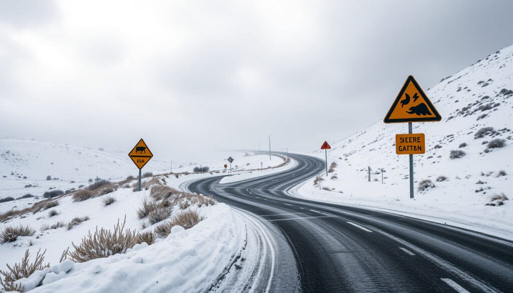
The road snowfall warnings highlight risks for alpine passes like Milford Road. State Highway 94 through to Milford Sound is the only sealed road serving one of New Zealand’s most visited tourist destinations, and closure or restriction of this route affects thousands of visitors and freight traffic annually.
Crown Range Road — the alternative route between Queenstown and Wanaka — is also under road snowfall warning due to snow settling. This route is narrower, more winding, and at higher elevation than SH94, making it particularly vulnerable to accumulation.
Drivers planning travel to Milford Sound or the southern lakes region should bookmark the MetService warnings page and check it before departing. Road conditions can deteriorate faster than headline forecasts suggest, especially when snow combines with the afternoon temperature drop.
The implication is that even short trips on these routes require real-time condition checks — the distance between safe passage and dangerous accumulation can be covered in under an hour.
What are the impacts of heavy snow in Otago and Southland?
The impacts range from minor travel delays to road closures with significant economic and safety consequences. Understanding the ripple effects helps readers appreciate why MetService invests in detailed road-level forecasting rather than simply issuing region-wide alerts.
Road closures risks
Milford Road and Crown Range Road both face temporary closure risk if accumulation exceeds the road surface’s drainage capacity or if visibility drops below safe thresholds for the Homer Tunnel’s length. The tunnel itself has no emergency pull-over areas, meaning vehicles stranded inside face prolonged exposure to cold and reduced oxygen from idling engines in an enclosed space.
More heavy rain on the way for South Island following snow and winds will test the road network further. Saturated ground after snowmelt plus additional rainfall creates heightened risk of washouts on lesser-maintained roads and localised flooding at stream crossings.
Preparation tips
Drivers should carry chains even if the current forecast shows clear roads — conditions can change rapidly as the front moves through. Essential items include a fully charged phone with offline maps, warm clothing in layers, food and water for a multi-hour delay, and a torch with spare batteries.
The New Zealand Transport Agency (NZTA) publishes real-time road status information alongside MetService alerts, giving drivers two official sources to cross-check before departing. Delays of an hour or more are common when road crews deploy chains and escort vehicles through affected sections.
Confirmed
- Road snowfall warnings issued for Milford Road and Crown Range Road
- 3 to 6 cm of snow possible about Homer Tunnel on Milford Road
- Strong Wind Watch for coastal Otago, Southland, and Stewart Island until 3pm
- Heavy Rain Watch for Otago headwaters for 11 hours from 10am to 9pm on 20 April
Still unclear
- Whether orange wind warnings will actually be issued
- Exact snow totals if thunderstorm activity develops near Homer Tunnel
- Duration of road snowfall warnings pending conditions
What this means for trip planning is that the confirmed hazards alone justify delaying travel, while the unknown factors mean even those already on the road face unpredictable conditions.
Timeline of the winter storm system
Five distinct timeline points mark this weather event’s progression from initial cold-air arrival through the incoming heavy rain phase.
| Date | Event |
|---|---|
| 19 Apr 2026 morning | Snow falls on Crown Range and Milford Roads |
| 19 Apr 2026 | Strong Wind Watch issued for coastal Otago, Southland, Stewart Island — active until 3pm |
| 19 Apr 2026, 6:27am | Forecasts issued for Milford Sound and Southland rural areas |
| 20 Apr 2026, 10am–9pm | Heavy Rain Watch for Otago headwaters begins (11-hour window) |
| 20 Apr 2026 | Active front arrives bringing heavy rain to Fiordland and Otago headwaters |
The pattern across these timeline points shows a classic cold front structure: initial cold-air advection delivers snow at low elevations, followed by wind intensification, then a moisture-rich warm sector bringing heavy rain. The South Island’s geography — with the Southern Alps perpendicular to the prevailing westerly flow — amplifies orographic precipitation on the western slopes and rain shadows on the eastern plains.
What experts are saying
Two named sources provide on-record context for this event.
“As fronts move up the country and winds turn southwest, we’re in for an influx of cooler air, which is forecast to bring snow to a couple of alpine passes in the far south.”
— MetService meteorologist, quoted by Otago Daily Times news report
“There was a strong possibility an orange warning would be issued.”
— MetService meteorologist, quoted by Otago Daily Times news report
These quotes illustrate two distinct aspects of the event. The first explains the meteorological mechanism — cold air injection following frontal passage creates conditions ripe for alpine snowfall. The second signals the severity signal from MetService’s own risk assessment apparatus, indicating the event crossed internal thresholds for elevated alert status.
The implication is clear: MetService’s own meteorologists believed this event warranted orange-level response, which represents a meaningful step up from the current watch status. Whether that upgrade occurred requires checking the live warnings page for current updates.
Related reading: Milford Road snowfall warnings
forecast.weather.gov, metservice.com, metservice.com, metservice.com, metservice.com, metservice.com
Frequently asked questions
Does it snow heavily in Otago?
Otago gets measurable snow most winters, particularly in its alpine and high-country zones. Heavy snowfall at lower elevations — like the current event affecting Crown Range and Milford Roads — occurs when cold air from Antarctica pushes north with sufficient moisture. The region’s location relative to the Southern Alps means eastern Otago often receives less snow than western districts but more than coastal Southland.
What snow warnings are in effect for Southland roads?
MetService has issued road snowfall warnings for Milford Road (State Highway 94) and Crown Range Road. The Milford Road warning specifies 3 to 6 cm of snow possible about the Homer Tunnel. Crown Range Road has a separate road snowfall warning due to snow settling. Both warnings are active as of the current reporting period.
When does the heavy snow start?
Snow has already fallen on Crown Range Road and Milford Road during the current event, with the cold blast arriving on the morning of Sunday 19 April. The timing for the heavy rain watch affecting Otago headwaters begins at 10am on Monday 20 April, lasting for 11 hours until 9pm.
Is Milford Road closed due to snow?
As of the current warning status, Milford Road (SH94) has a road snowfall warning in effect but is not confirmed closed. Road snowfall warnings indicate hazardous conditions that may lead to restrictions or temporary closures, particularly near the Homer Tunnel where accumulation is most likely. Drivers should check the NZTA and MetService warning pages for real-time status before attempting this route.
What other weather is accompanying the Southland snow?
A strong wind watch is active for coastal Otago, coastal Southland, and Stewart Island until 3pm. Gale-force west-to-southwest winds are expected to spread northwards, potentially reaching severe gale in exposed coastal areas. The system also includes heavy rain watches for Otago headwaters and potential thunderstorm activity near Homer Tunnel that could intensify snow accumulation.
How should I prepare for driving in Otago snow?
Carry tyre chains even on clear forecasts — conditions change rapidly in alpine zones. Pack layers of warm clothing, food, water for multi-hour delays, and a torch with spare batteries. Check both MetService warnings and NZTA road status pages before departing. The Homer Tunnel is particularly hazardous during snowfall due to limited emergency pull-over space and enclosed-space driving conditions.
Where can I find the current MetService snow forecast?
MetService operates the official warnings page at metservice.com/warnings/home with real-time updates on all active watches and warnings. The Milford Sound regional forecast page provides hourly updates for that specific location, while the Southland rural forecast covers the broader agricultural region. The ski-fields forecast page covers alpine snow levels for the southern ranges.
More related posts
 Knicks vs Celtics Match Player Stats: Feb 8, 2026 Box Score
 Canon R5 Mark II vs R5 & R6 Mark II: Specs & Value
 Jet Ski Incident Port Waikato: Tragic Christmas Day
 755 Regal Court Motel – Dunedin Self-Contained Stay
 McDonald’s Price List NZ 2025: Menu Items, Big Mac & Deals
 Flight Centre Palmerston North – Address, Hours, Phone & Services
 Villa Maria College Christchurch: Fees, Ranking & History
 Cast of Alice in Borderland: Actors & Characters